Better data for sustainable buildings and cities.
We are witnessing a tectonic shift in construction and real estate portfolio management towards more energy-efficient solutions.
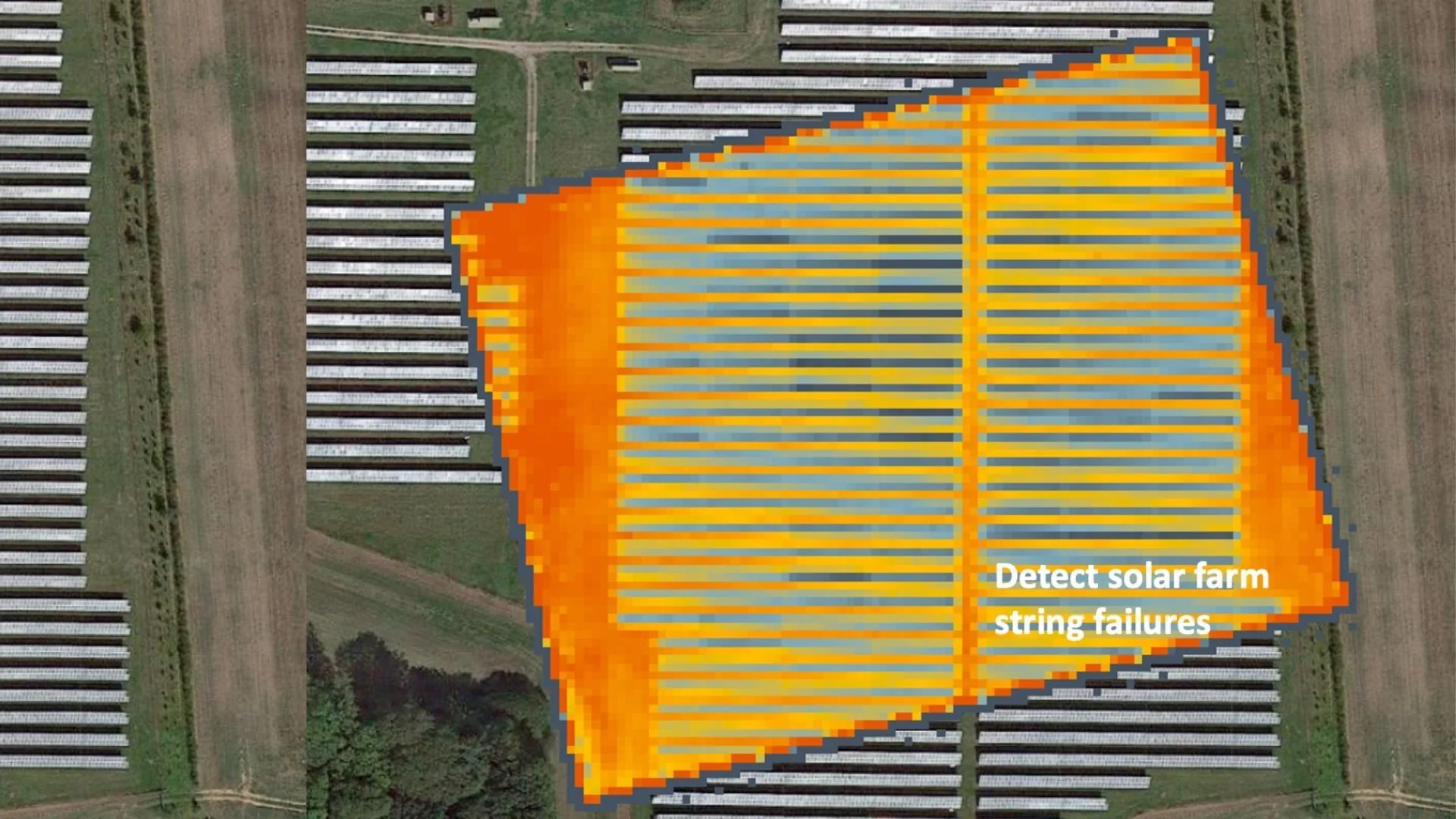
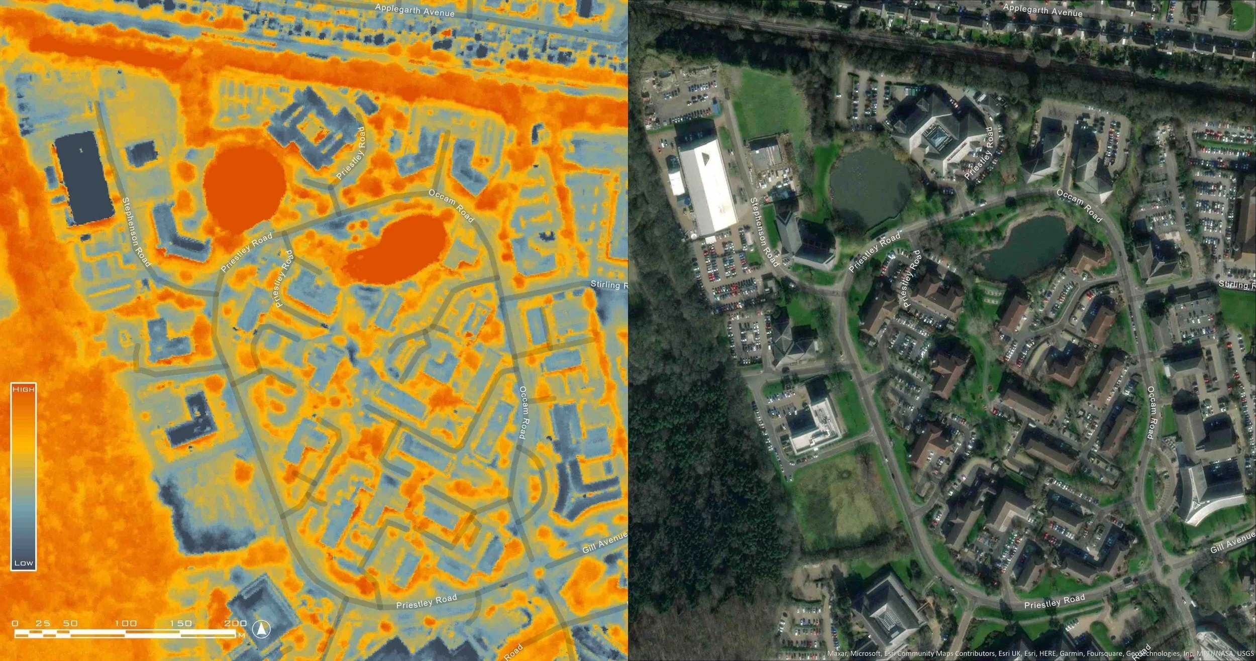
Entities that now rely on energy performance ratings lack adequate resources to compare the behaviour patterns of buildings. It has been impossible to identify structures that have high thermal energy wastage and to indicate where retrofitting to improve efficiency would be most valuable. Currently thermal surveys of structures are carried out with aerial systems or drones but are very expensive. At the same time, the available Landsat data is very coarse at 100m resolution.
With SatVu’s constellation of satellites, you will be able to detect thermal emissions from anywhere in the world, in high resolution and near-real time. The satellites will offer a frequency of data collection that has not been available before.
Our partners


The insights from our satellites will enable investors, property developers and building owners to guide their policies based on regular inspections of their assets. Equipped with this knowledge, businesses can truthfully achieve their international energy targets.

Heat Loss Insights from Urban Structures
This unique technology will provide a greater understanding of the intensity and frequency of heat wastage from buildings. SatVu is working on highlighting the urban structures emitting the most heat, allowing for further insights to be developed. The workflow will include gathering data within a scene, attributing a heat signature to buildings and ranking them according to their thermal efficiency.
Harness the power of thermal data to improve energy efficiency in buildings and mitigate the urban heat island effect
SatVu’s MWIR sensor is able to deliver thermal imagery at an unprecedented resolution; 3.5m at NADIR. Compared to traditional payloads operating in thermal, the resolution is an order of magnitude higher.